


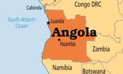
Angola’s Ministry of Geology and Mining has signed a deal with three foreign firms to survey the country’s geophysics and geochemical situation and train Angolans to run the National Geological and Mining Plan (Planageo).
Angola’s Minister of Geology and Mining, Francisco Queiroz, said that training was a big concern in the management of the Planageo project nationwide. Queiroz said that the objective of Planageo is to determine the country’s existing mining potential, which will be determined through geological mapping using aircraft to gather geological data.Locating mineral deposits
The contract makes provision for the training of Angolan personnel by three companies that will be working in the geophysical and geochemical survey, stated Queiroz, who did not name the companies involved. A fourth firm will provide advice to the Ministry and to the Geological Institute for the management of the project, as there is no local capacity, said Queiroz. He said the planes survey flights will help establish the locations and potential of the mineral deposits in the country.An inaugural aero-geophysical survey flight was undertaken in Angola’s Cuando Cubango province on 19 June. The flight was coordinated by Costa Negocios – a Planageo service provider.

