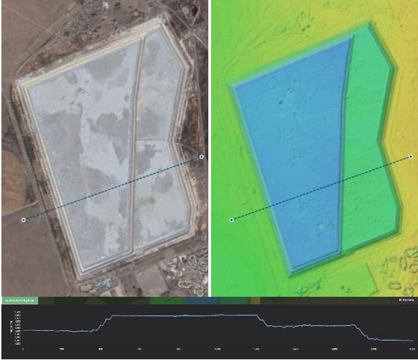
As the time approaches rapidly for mining companies to start reporting on the safety and monitoring of their tailing storage facilities (TSF), several proof-of-concept studies are being undertaken that range from physical site monitoring to a range of remote sensing methods.
Satellite monitoring is one of the more time and cost-effective options that are being considered for continuous monitoring of both active and historic sites. Satellite based monitoring can be performed for the full life cycle of TSF, from construction, through construction and utilisation to post-closure, says Sonja Goosen MD at Pinkmatter Solutions. The combination of optical and synthetic aperture radar (SAR) methods allows a TSF to be continuously monitored, based on the risk potential that has been assigned to the specific site. Pinkmatter Solutions has developed the FarEarth Change Monitor platform, that utilises both of these satellite sensor types, making it truly sensor agnostic, and making it a web-based platform that allows users to both view and interrogate satellite data to make informed decisions on time sensitive issues, such as the evaluation of TSF safety or risk detection mitigation. The advantages of using satellite platforms include: the uninhibited access to anywhere in the world and near fully automated systems. The reduction of travel and of the number of staff required to conduct a survey has cost benefits. It also nearly eliminates the need to physically move around potentially dangerous mine workings and unsafe areas on and around a TSF, adds Goosen.Using satellite imagery
Satellite imagery or SAR data is used to supplement or validate ground data being generate. Ground investigations range from site investigations that is performed on set intervals such as monthly or quarterly. Instruments are also installed in the TSF, that feed measurement data either in real-time or is collected. The type of data collected include, pond elevation, piezometric pressures, inclinometer readings and weather conditions. The installation of fibre optic cables (FOC) has allowed real-time observation of tailing facility monitoring up the second, capable of detecting sub-millimetre scale movement. The real-time data is relayed via satellite uplinks or directly to surveillance centres to alert of any critical changes detected. FOC is valuable for catastrophic failure warnings where there are no precursor indicators of potential failure.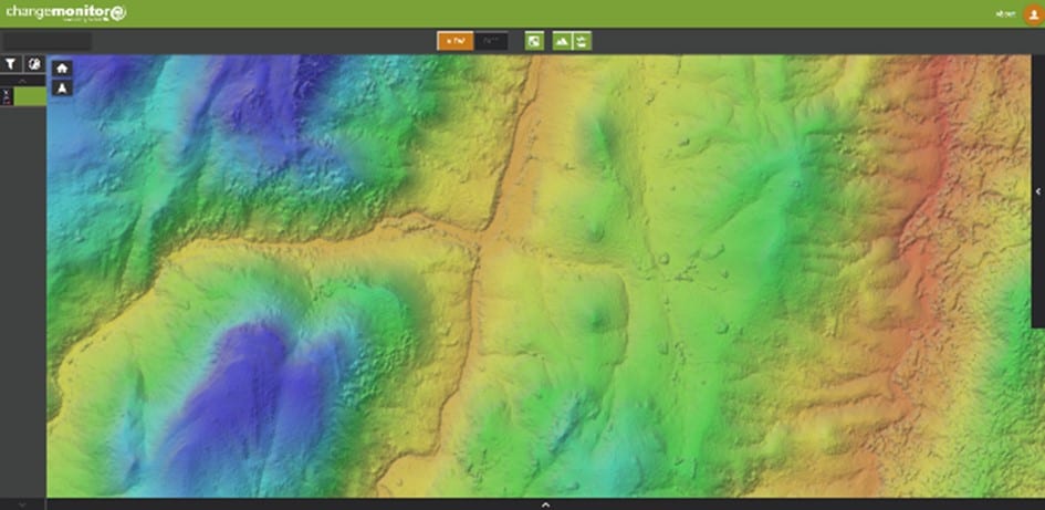
Monitoring surface water
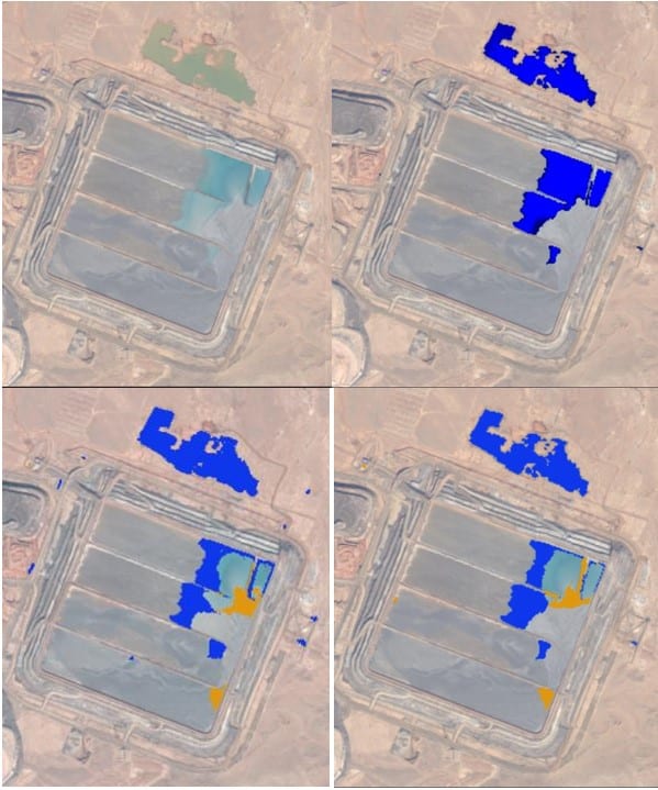
Surface water accumulation monitoring, both deposited tailing and meteoric water, on a TSF is a critical function from both an operation and safety point and form part of the pool management requirement. The monitoring is performed by regularly scheduled optical satellite image acquisitions. The automated output can be programmed to generate a warning at the monitoring centre if the surface water reaches a dangerous areal extent, continues Steenkamp.Mine survey departments and the engineer of record also need to be aware of the volume changes of a TSF of time. The best volume estimations are derived from models where a baseline DEM is used to produce high accuracy elevation models and volume change calculations. The FarEarth Change Monitor system receives and automatically orthorectifies the images using precision ground control points (GCPs). Photogrammetry methods applied from stereo high-resolution optical images, produce volume products that are compatible with results from LiDAR surveys, if the previous mentioned criteria are met.
Risk management
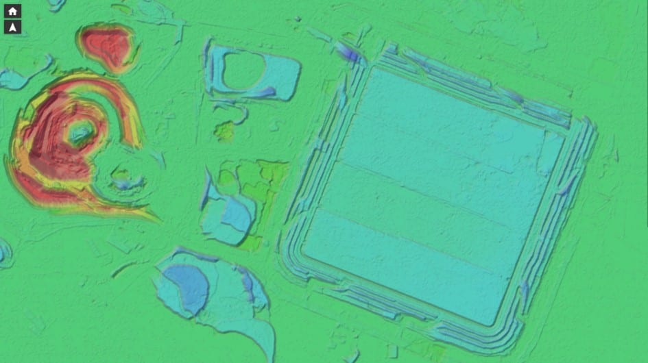
Failure risk management is done by SAR, says Goosen, as it is able to monitor a site both day and night, is not affected by weather conditions such as cloud cover. SAR data has a horizontal resolution of about 3 meters on commercial platforms and 20 meters on public domain, but has is capable of detecting vertical changes of less than 5 millimetres. The application is however limited by the presence of deep-water bodies in proximity to the TSF, dense vegetation on top of the TSF, for example as part of stabilisation or older sites and very dynamic sites where some active mining is undertaken, notes Steenkamp. This is mitigated by the installation of corner reflectors that assist in detecting movement on the TSF. Once a sufficient baseline has been established for the TSF, is possible to create more accurate surface movement monitoring (SMM) and modelling, utilising Interferometry SAR (InSAR) or where corner reflectors has been installed the persistent scatterer interferometry (PSI) results. The output generated on the FarEarth Change Monitor is graphic and highly intuitive to the user, where a heatmap approach is used to delineate areas of movement. Areas with movement in excess of the tolerance or time is indicated in hot colours such as red, with cooler colours indicating acceptable subsidence over time, such as the indicated settlement rate of the tailings material. The results can then be viewed by the user online via the web-based platform. It is also possible to generate a report that can be downloaded from a secure FTP site. Other relevant data such as the inverse velocity graph would then be included, according to Steenkamp.