Health related travel restrictions have added to the
challenges of monitoring remote mining operations, but satellite imagery offers
the solutions.
After Covid-19 was declared a pandemic by the World Health
Organisation (WHO), most countries have responded by imposing travel bans,
travel restrictions and quarantine measures. Monitoring of remote mining
operations have always been notoriously challenging to monitor. In most cases
it would require mobilising skilled resources to visit the operations, conduct
the legal observations such as environmental monitoring or safety inspections
of excavations or material storage facilities or physical surveys. This also
comes with a substantial price tag for travel, living-out allowances or danger
pay. For the near future it would also appear that the viability of ad hoc site
visits would be restricted.
There is however a quick and easy to implement solution to
conduct on-going operational surface monitoring without interruption. High
resolution satellite imagery coupled with a change detection and visualisation
platform being one of the top options. This allows management and responsible
persons to monitor mining operations from a secure location or from home if
need be.
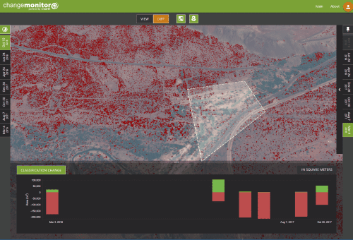
A screenshot of vegatation change detection
Pinkmatter Solutions have developed the FarEarth Change
Monitor platform and have technical partnerships with the leading Earth
observation satellite operators. The FarEarth Change Monitor is a web-based
platform, capable of performing calculations on-the-fly. This means the platform
can be accessed anywhere in the world with internet access and requires no
specialist software to be installed and flexible subscription options. The
platform is highly automated and intuitive to use. Satellite image acquisitions
can be scheduled according to the customer’s requirements. Once the image is
acquired, products such as elevation models are available on the change monitor
platform within 48 hours. The subsequent images can be utilised for surface
change monitoring, with the value of the interpretations and data increasing as
the number of images in the series increases. Selected products can also be
downloaded from a secure FTP site.
High level observations and monitoring can be done by
scrutinising high resolution optical images that have been cropped to focus on
the mining operations or the general area of interest. These images are
frequently printed in large format and pinned to offices walls and form the
focus for planning or updating meetings. Optical images are collected in the red,
green, blue (RGB) and near-infra red (NIR) spectrums. The imagery is used to
track and visually represent surface changes, ranging from the areal extent of
surface operations, surface water, surface disturbances and the addition or
removal of surface infrastructure. FarEarth Change Monitor allows users to draw
their own area of interest polygons, lines or points to measure objects at a
specific time or to display changes over a time series. These measurement and
shapes can then be shared with other users on the same platform and is a very
popular application during management or board meetings.
The NIR spectrum also allows for environmental monitoring
using the normalized difference vegetation index (NDVI), where the distribution
of green vegetation can be monitored. Phenology curves and classes are
displayed in easy to understand graphs by the FarEarth Change Monitor.
It is also possible to perform volume calculations of
excavations and material stockpiles or residue deposits, utilising
photogrammetry. The volumes are displayed by the FarEarth Change Monitor for a
single observation and over a time series, offering a quick and easy way to
monitor the movement of materials and stockpiles. Two clicks are all it takes
to draw a cross-section of either the topography or mining operation features.
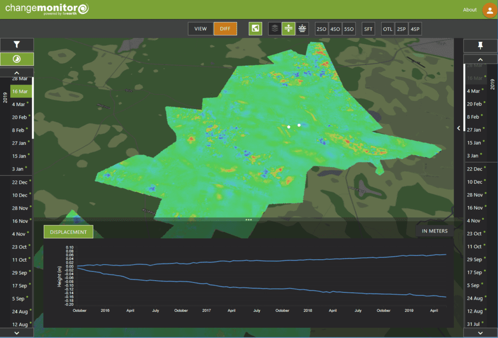
Interferometry synthetic aperture radar (InSAR) is used with
great success to monitor surface subsidence, either due to natural processes,
such as karst landscape formation in dolomitic areas or as a result of mining
induced subsidence. It is also used in stability monitoring of tailing storage
facilities and dam walls. SAR offers an alternative to generate volume products
is areas prone to prolonged cloud cover, such as the equatorial regions.
Surface subsidence monitoring
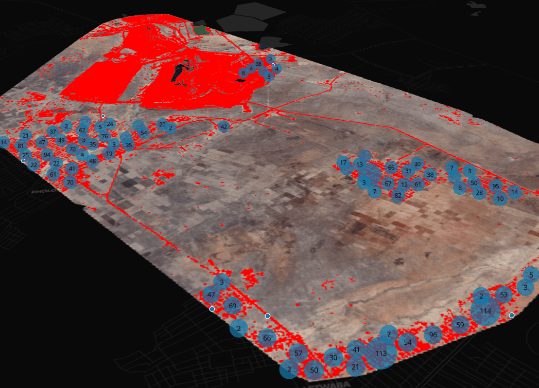
Artificial intelligence (AI) can also aid in risk
identification and remediation. Functions range from fire detection platforms,
like the FarEarth FireBox that alerts emergency response teams to active fires
in near real time. It also offers the ability to manage environmental social
and government (ESG) issues proactively through applications such as settlement
expansion or encroachment monitoring on mining lease areas. The system can also
assist in detecting unauthorised activity on-site during a period of temporary
suspension of operations.
Satellite imagery-based change detection and reporting
platforms offers a safe and cost-effective alternative to remote site
monitoring. Allowing companies, the ability to remain up to date on operational
and site issues, without having a constant site presence.